By Casey Neill
DANDENONG Ranges residents have welcomed plans for ‘safer places’ on the mountain ahead of the coming fire season.
The State Government last week named Gembrook, Cockatoo and the Dandenongs’ western towns among areas in Victoria most vulnerable to bushfires.
The fire service identified the hot spots based on dryness, fire spread potential, population density, access, preparation and planning requirements.
Monbulk MP James Merlino said CFA brigades, communities, local government and Department of Sustainability and Environment would now join forces to create township protection plans for the affected areas.
“This is about using the local knowledge,” he said.
“It will be about identifying places to go as a last resort. You cannot completely guarantee the safety of anywhere in the middle of a wildfire.”
He said the plans would address the specific needs of individual towns.
Mt Dandenong, Sassafras, Kalorama, Tremont, Olinda, Kallista, Belgrave Heights, Belgrave South, Selby, Upwey, Mt Evelyn, The Patch, The Basin, Montrose and Upper Ferntree Gully were the Dandenong Ranges towns named most at threat.
Belgrave man John Peacock welcomed the safer places plan.
Mr Peacock served as a firefighter for 54 years and is now a member of the Dandenong Ranges Community Bushfire Group.
“Regardless of what some people think, there’s no way everyone’s going to disappear off the mountain,” he said.
“People are going to stay and they need a place to go.”
Streeton Ward councillor Noel Cliff said safer places were a crucial last resort to prevent panic on congested and winding hills roads.
He said some residents planned to stay but panicked when the flames approached.
“One prang will cause traffic chaos,” he said.
Ferntree Gully MP Nick Wakeling said the State Government needed to provide further details on what township fire protection plans would involve.
He also said the government had not yet committed to increasing fuel reduction burns, contradicting the June 2008 Environment and Natural Resource Committee’s Inquiry into the Impact of Public Land Management Practices on Bushfires in Victoria.
The report recommended a tripling in fuel reduction burns.
The issue was the most frequent topic in the 1200 submissions to the Victorian Bushfires Royal Commission, but none of the interim report’s 51 recommendations addressed the issue.
Mr Merlino expected community debate to continue regarding vegetation.
“We’ve just got to keep balance between protecting homes and why we live here,” he said.
Dandenong Ranges Community Bushfire Group spokeswoman Jo Hurst urged the shire to review current policies and overlays.
“Considering over one-third of submissions covered fuel reduction, it should have been addressed,” she said.
Shire of Yarra Ranges Mayor Len Cox said clear and simple statewide guidelines were necessary to manage vegetation.
“However, this needs to be a scientific and measured response because going too far can be counter-productive and in fact create more issues, such as increasing landslip risks,” he said.
The Victorian Bushfires Royal Commission’s final report is due next July.
Dandenong Ranges Community Bushfire Group will hold a public meeting at Mt Dandenong Hotel at 7.30pm on Monday 21 September.
The group has invited Sire of Yarra Ranges councillors, MPs and CFA, VicRoads and DSE representatives.
Anyone who would like to attend can call Jo Hurst on 9755 2272 or send an email to duncjo31@aapt.net.au to RSVP.
‘Safer places’
Digital Editions
-
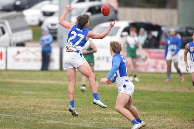
Brookers come out on top
Purchase this photo from Pic Store: 490838 It was a blustery day on the hill over the weekend, but that didn’t stop the Senior team…