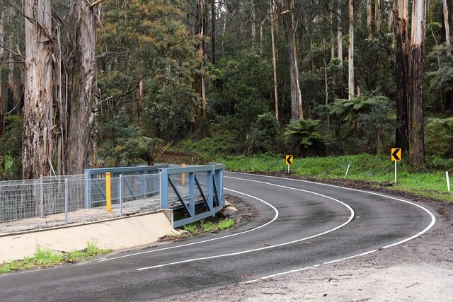
New road safety ratings have been revealed for some of Australia’s most well-travelled roads, and a few in the Yarra Ranges have been identified as areas of concern.
Austroads, the association of Australasian road transport and traffic agencies, has made public safety star ratings for Australia’s major arterial roads on a National Australian Road Assessment Program (AusRAP) Dashboard.
Ranked from one star to five stars, a few roads throughout the Yarra Ranges have received the lowest possible rating:
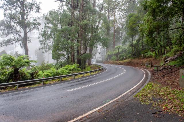
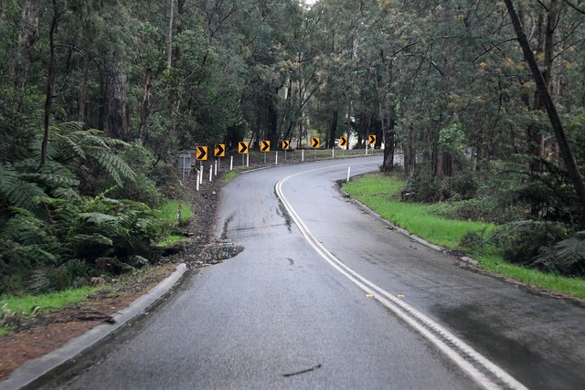
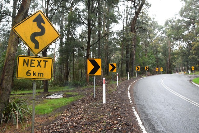
Healesville-Kinglake Road between Toolangi and Chum Creek, the Black Spur Drive on Maroondah Highway in Fernshaw, stretches of Don Road in Badger Creek, Mount Toolebewong and Don Valley, Donna Buang Road in Warburton, Warburton-Woods Point Road from East Warburton onwards, a section of Yarra Junction-Noojee Road in Powelltown, Gembrook-Launching Place Road between Hoddles Creek and Gembrook and Gembrook Road from Gembrook to past Pakenham Upper.
Most of the highest-rated roads in the Outer East are 3.8 stars:
Anderson Street between Pine Street and the roundabout in Lilydale, Mt Dandenong Road through Montrose and Kilsyth between Magnolia Grove and Charles Street, Forest Road in The Basin between the Mountain Highway roundabout and Harcourt Road, Monbulk Road between Clegg Road and Aqueduct Avenue in Mt Evelyn, bell Street and the start of Healesville-Yarra Glen Road in Yarra Glen and Badger Creek Road up to Cornish Avenue in Healesville.
A few exceptions reach above a four-star ranking:
Maroondah Highway between Badger Creek Road and White Street in Healesville, Symonds Street up to the start of Eltham-Yarra Glen Road in Yarra Glen, the Warburton Highway between Wesburn Park and The Crescent in Wesburn and again between Mayer Bridge and the end of the Warburton Rail Trail in Warburton.
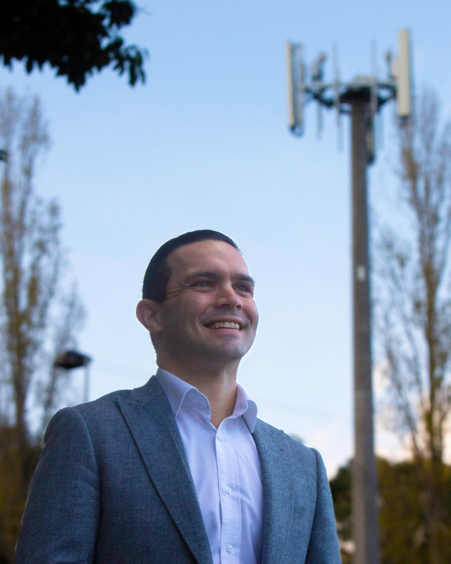
Automotive journalist Robert Pepper said he drives along the Black Spur around 15 times a year on average and said it is a critical route to the Marysville area for residents, while also being windy and scenic, so popular with the sports car fraternity, and often used by four-wheel-drive enthusiasts on their way to the various forests around Marysville and beyond.
“The road is very different to ‘normal’ roads – it is narrow, has many sharp turns, blind corners, is often cold and wet and isn’t particularly steep but there are gradients, that is my guess as to why it has a one-star rating and I’m not sure how the rating systems work, but the rating is probably appropriate,” he said.
“However, the major safety concern I’ve noted is drivers without the skills to handle the road.”
Mr Pepper identified a number of ways drivers are unprepared for the troublesome stretch of Maroondah Highway, largely related to speed and an understanding of the conditions.
Mr Pepper said specifically that drivers are failing to slow the car sufficiently for a corner downhill, running wide, as the driver is clearly not used to such a road.
“You can often see brake lights flash on and off multiple times around a corner as the driver is mentally behind the car, reacting too late, braking for an uphill corner when there’s no need, vs not braking enough for downhills,” he said.
“Not keeping within the narrow lanes, holding up traffic; maybe accelerating on short straights, but over-slowing for corners, and not using the slow-vehicle passing points.
“An appreciation of how much the risk changes from a hot, sunny day to a dark, wet, rainy night with leaf litter all over the road (grip, vision, risk of tree fall) and dealing with blind corners vs vision corners.”
Mr Pepper highlighted the impact of risk compensation theory in driving, where the safer the road, the more likely drivers are to take risks and vice versa.
Mr Pepper said the biggest improvement for driving on the Black Spur would be driver training. “The driver training and test does nothing to prepare drivers for rural roads generally, and the Black Spur is a great example – fix the driver, and suddenly all roads become safer, so to my mind that’s cheaper and more effective than trying to upgrade road after road,” he said.
“Following another car within thirty seconds, whether it’s someone experienced with such roads, or a driver who is new to such roads.
“As for specific upgrades, it would be best to analyse the data from crashes and incidents to identify root causes. I don’t have that data, but I can’t imagine it’s cost-effective to widen the road and that would just potentially increase speeds – there is ample evidence that the safer the road, the greater the risk taken.”
The road safety ratings factor in built safety features such as road layout, speed limits, and traffic volumes and do not consider driver behaviour.
The dashboard also presents at least five years of crash risk data for each road based on crash density (the number of serious crashes per kilometre of road per year) and crash rate (serious crashes per 100 million vehicle kilometres travelled).
Austroads chief executive Geoff Allan said not all roads are equal when it comes to risk.
“That’s why the focus of AusRAP is on the country’s most travelled roads – the highways and major arterial routes where millions of Australians drive every day, and where fatal and serious injury crashes are most likely to occur,” he said.
“By publishing star ratings and crash history data on a single, national dashboard, we’re giving governments and the community a clear line of sight to where upgrades will have the greatest impact.”
The national road safety target sets a goal that by 2030, at least 80 per cent of travel occurs on three-star roads or better, supporting Australia’s Vision Zero goal of zero deaths or serious injuries on roads by 2050.
The Australian Automobile Association (AAA), which introduced AusRAP in 2001 before handing over the reins to Austroads in 2021, welcomed the release of the ratings and managing director Michael Bradley said data transparency will save lives.
“The AAA thanks each of the governments releasing this life-saving data for listening to the views of Australian motorists and safety campaigners,” he said
“Now that this critical data is being made public, Australians can compare which roads attract government funding with independent data about our most dangerous roads and highways.”
“This is great news for motorists and should lead to decision-making based on evidence, not politics.”