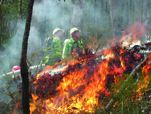
A planned burn is scheduled for the top of Mount Dandenong today (Thursday 23 May).
“This is a highly visible and important burn that will take place adjacent to SkyHigh restaurant on Observatory Road and in the vicinity of the telecommunications towers,” Forest Fire Management Victoria (FFMVic) metro district manager Kylie Hyland said.
“This 10-hectare strategic burn is part of FFMVic’s program to reduce the bushfire risk to people and property in the Dandenongs.
“It will help to protect important assets including tourism operators, recreational facilities, telecommunications, as well as protect assets such as homes and water supply by reducing fuel loads.
“It is vital that we take every opportunity to complete asset these protection burns whenever conditions are suitable and it is safe to do so.”
Ms Hyland said that weather permitting, crews would ignite the burn in the early afternoon.
“People may see flames and smoke at the top of the Mount Dandenong well into the evening,” she said.
“Crews will remain on site throughout the night and in coming days to patrol the burn.
“Road travel in the Dandenongs may be hazardous due to low visibility associated with smoke from this burn.
“If driving through smoke, slow down, turn your headlights on and obey traffic signs.”
The SkyHigh restaurant will be open as normal.
A number of tracks will be closed before and after the Kyeema Track planned burn, including the Kyeema Track (between Bourke’s Lookout and Observatory Track), Observatory Track, and The Scar Track.
Visit www.ffm.vic.gov.au/plannedburn, download the Vic Emergency app or call the VicEmergency hotline on 1800 226 226 for more information.