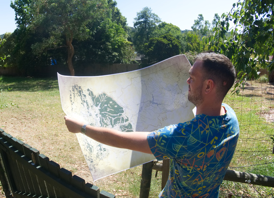
“When pen hit paper, Mount Evelyn was the first place it started,” said Brunswick cartographer Adam Mattinson.
This Sunday, Adam Mattinson will launch a map of Mount Evelyn that is unlike any other.
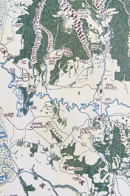
The map looks like something ripped from the pages of a Tolkien book with pyramidal mountains like sharp teeth, forests of glyph-like trees, hand-inked names and even a dragon or two.
But the points of interest on the map include iconic locations around the Mount Evelyn area.
Adam Mattinson spoke to the Mail about the recently released map, which will eventually cover the entire Yarra Ranges Shire.
With this big map that’s where i started when pen hit paper that’s the first spot it started.
Before i had it in my mind for the whole shire i thought I’d just start with Mount Evelyn.
I’ve put a lot more details in this Mount Evelyn map.
Those details include areas of historic and environmental significance.
“I’ve gone through historic paper and added areas that have some kind of heritage significance,” Mr Mattinson said.
“Beyond that I also looked at the natural history too and up near Coldstream, Olinda Creek used to be a giant swamp but it’s been drained so I’ve included that.”
“It’s been really interesting to see how the towns evolved.”
Although the map began as a personal endeavour, Mr Mattinson said he has enjoyed the interest it has garnered from locals.
He said the map covers a wide area of the Mount Evelyn region and that copies of the map will be available sell at the launch.
“This map goes as far south as Silvan and north as Coldstream, Chirnside Park in the west and Wandin in the east.”
The Mt Evelyn Community House is hosting the launch of the much anticipated Mt Evelyn Tolkien style inspired map on Sunday 7 July at 11am. Mr Mattinson will be speaking about the map and sharing an insight into cartography at the event.