To help keep their mapping, planning and preparation up to date, The Victorian Government has made funding available for local councils facing flood risks.
Minister for Water and Member for Eastern Victoria Harriet Shing and Minister for Planning Sonya Kilkenny revealed an investment of $22.2 million on Tuesday 30 May to encourage councils to fast-track their flood studies and preparation, particularly after the October 2022 floods that hit multiple regions across the state.
“We appreciate this funding becoming available from the State Government, and will take it into consideration when undertaking projects, like the development of our Storm Water Management Plan (SWMP) in coming months,” said Director of Planning and Sustainable Futures at Yarra Ranges Council Kath McClusky.
“Flood mapping catchment prioritisation will be a key part of the SWMP once it gets underway, and we will share more with the community as it progresses.”
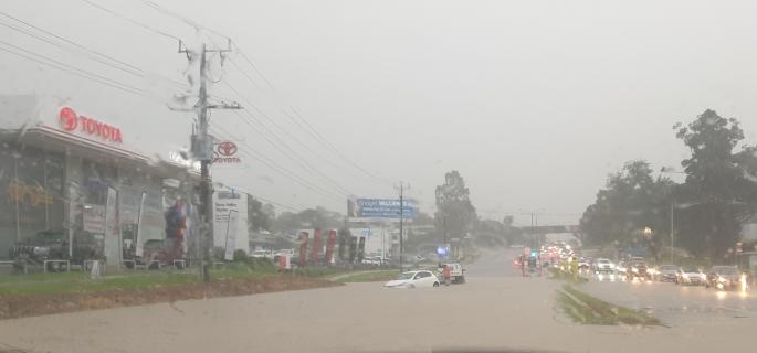
In areas of the Yarra Ranges such as Lilydale, Seville, Coldstream and Mooroolbark, close to 75mm of rain fell in around an hour and a half, with a five-minute window of rain falling at an astonishing 120mm per hour on Tuesday 26 October 2022.
“We’re helping any remaining local council to fast-track updates to their flood maps and other data to ensure we have the best information on the risk of flooding,” said Ms Shing.
“These flood studies will support emergency management activities, planning decisions and individual landowners living on the floodplains.”
$10 million of the funding package will complete an estimated 32 flood studies over five years, $5 million will fast-track the scoping process for more flood mitigation efforts over three years, $3.9 million over two years will help implement 40 flood studies into planning schemes and $2 million is put aside to help councils engage crucial landholders, builders and industries.
“We’re making sure the latest flood data is being reflected in Victorian planning schemes, to help create safer and more resilient towns across flood-prone parts of our state,” said Ms Kilkenny.